 Click on the image to enlarge it. |
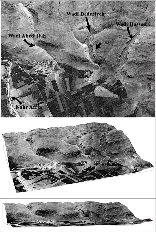
Satellite image of Jabal Samaan, Afrin Valley. It shows the distribution of three wadis in the Afrin Valley (Wadi Abedallah, Wadi Dederieyh, and Wadi Hassan from left to right). The cave (36° 24´N; 36° 52´E), at an elevation of 450 m above sea level, lies on the left bank of Wadi Dederiyeh, which crosses the western slope of Jabal Samaan, the east boundary of Afrin Valley in the northern extremity of the Dead Sea Rift. The cave is located about 500 m up the Wadi Dederiyeh. The arrow shows the chimney entrance of the Dederiyeh Cave (from Akazawa and Muhesen, 2003a: Fig. 1). |
 Click on the image to enlarge it. |
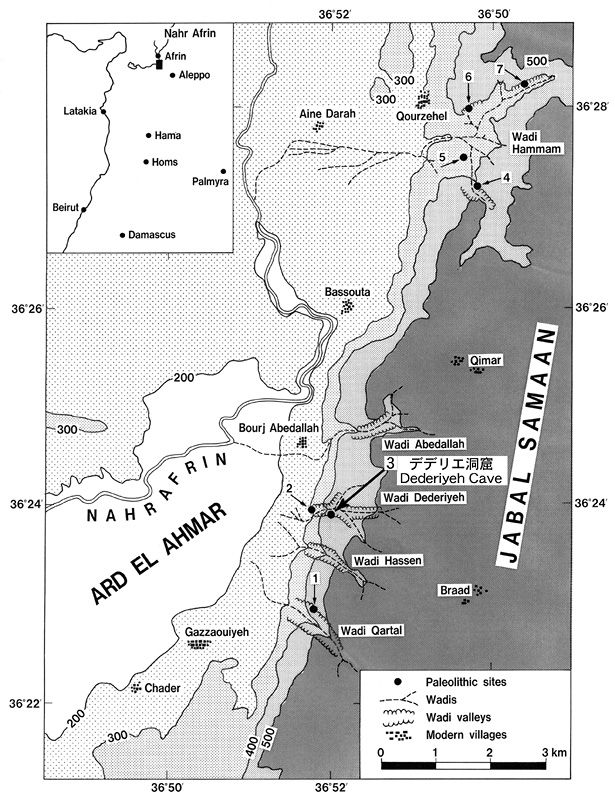
Topographical map of Afrin Valley. The Dederiyeh Cave (No. 3) is one of several found in an extensive reconnaissance survey by a joint Japan-Syria project in the Afrin Valley of northwestern Syria in 1987. The cave (36°24'N; 36°52'E), at an elevation of 450 m above sea level, lies on the left bank of Wadi Dederiyeh, which crosses the western slope of Jabal Samaan, the east boundary of Afrin Valley in the northern extremity of the Dead Sea Rift. 1. Qartal Cave, Levantine Mousterian; 2. Dederiyeh Cave No. 1, Upper Paleolithic; 3. Dederiyeh Cave No. 2, Levantine Mousterian and Natufian; 4. Hammam Cave No. 2, Levantine Mousterian; 5. Hmmam Open-Air Site, Levantine Mousterian; 6. Hammam Cave No. 2, Upper Paleolithic; 7. Hammam Cave No. 3, Upper Paleolithic (from Akazawa and Muhesen, 2003a: Fig. 2). |
 Click on the image to enlarge it. |
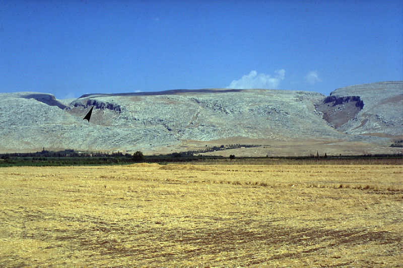
Scene of the western slope of Jabal Samaan. A horizontal fault line runs north-south dividing the Afrin Valley and the Samaan Mountains. The wadi which erodes the cliff of this fault runs east-west. The Dederiyeh Cave is located about 500 m up and on the left bank of Wadi Dederiyeh (left: an arrow shows the cave entrance) (from Akazawa and Muhesen (eds.), 2003: Frontispiece 3). |
 Click on the image to enlarge it. |
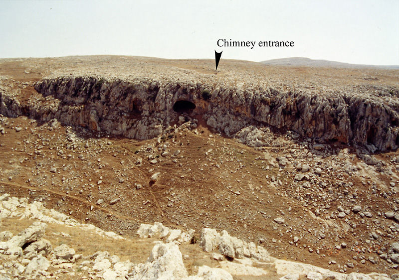
Wadi Dederiyeh and the Dederiyeh Cave. The entrance of the cave facing the wadi, for the north, is reached by climbing about 60 m up from the valley floor; after another 10 m there is the mouth of a second entrance, that of the chimney. The present mountainous zone is completely open and very sparsely vegetated (from Akazawa and Muhesen (eds.), 2003: Frontispiece 5). |
 Click on the image to enlarge it. |
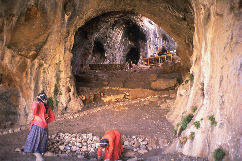
Inside the Dederiyeh Cave. The cave consists of a large chamber of 15 m wide and 10 m high at the entrance, and about 60 m deep and a maximum width of 40 m with a vaulted dome reaching heights of 10 m at the back of the cave (from Akazawa and Muhesen (eds.), 2003: Frontispiece 6). |
 Click on the image to enlarge it. |
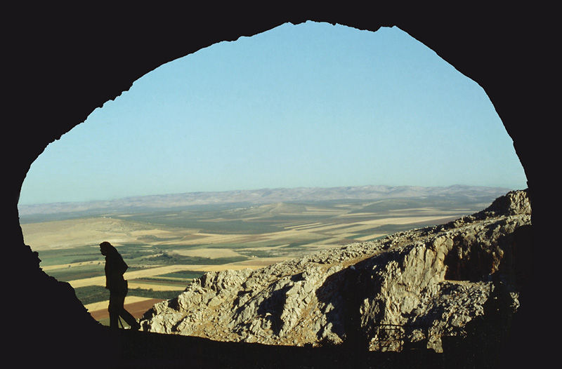
Chimney. The chimney at the back of the roof served as an entrance and as a source of light for the Neanderthals. |
 Click on the image to enlarge it. |
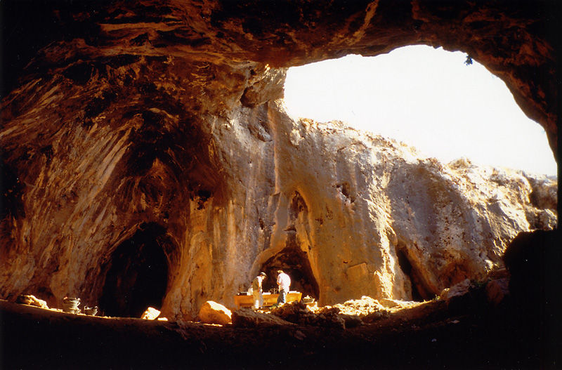
Scene of the excavations taken from the chimney. The chimney at the back of the cave as an entrance and as a source of light for the Neanderthals. The first Dederiyeh Neanderthal child's burial (Burial No. 1) is under the green sheet (from Akazawa and Muhesen (eds.), 2003: Frontispiece 7). |
 Click on the image to enlarge it. |
The world of the Dederiyeh Neanderthal. The cave, named "Dederiyeh", is found in the Afrin Valley located at the northern end of the Dead Sea Rift Valley, which served as the first corridor in the human expansion "Out of Africa" into the Eurasian continent. |
 Click on the image to enlarge it. |
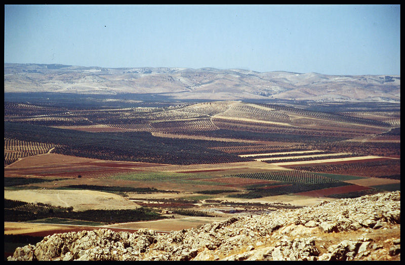
Scene of the Afrin Valley taken from the Dederiyeh Cave. The Afrin Valley surrounds the Afrin River which flows down from the Anatolian Plateau. A region is a dynamic focus of the movement of humans out of their place of origin in Africa, which served as the first corridor in the human dispersals "Out of Africa" for the onward journey to Asia and Europe. |