
- TOP
- Cutting-edge Research and Social Contribution
- Cutting-edge Research
- A comprehensive spatial information database for researchers: Supporting scientific advances
A comprehensive spatial information database for researchers: Supporting scientific advances
TAKAGI Masataka
- Specialized field
Geomatics
Remote sensing is a technique for obtaining various information about the earth's surface remotely, using satellites, while geographical information system (GIS) is used to process and analyze the data, which includes positional information obtained via remote sensing. Working with these two fundamental technologies, Professor Takagi conducts research on topics such as the utilization of geographical data, the analysis of slope disasters and social infrastructure applications.
Prof. Takagi says, "In order to demonstrate that artificial satellites can observe objects with high precision, it is essential to have measurements made on the ground." He explains that his research activities place much greater weight on making measurements in the field, confronting nature, than on analyzing the data obtained from satellites.
Prof. Takagi continues, "It is of great importance to verify the data obtained by satellite with human eyes on the ground. While making full use of state-of-the-art technology for measurement and analysis, I like to confirm that data with information acquired through actual observation in the field."
On the theme of high-precision satellite remote sensing, Prof. Takagi has been accumulating a wide variety of satellite images and geographical information, mainly related to the vegetation, topography and geology of Shikoku. By supplementing these vast amounts of data with information about such aspects as plant resources and social and cultural knowledge, he is currently pursuing his objective of gathering social infrastructural information that can be applied to industrial policy formation and disaster prevention measures. However, map-based representation of social and cultural events or natural events that require ongoing field surveys is difficult, so we are still not able to utilized those events as social infrastructural information. To solve that problem, it is essential to develop analytical methods that can express the acquired data in an easy-to-understand manner and thus support the utilization of that data.
Prof. Takagi explains, "Remote sensing and geographical information systems are evolving year by year, but most of the observation data from satellites cannot be utilized as it is. In the course of analyzing data like that, I aim to build an analysis technique that can express large amounts of data in an easy-to-understand manner. In that light, my goal is to build a versatile database that will allow researchers any-time access to useful information. I would like to make it easy to use for all researchers; this will surely lead to enhanced scientific research."

Professor Takagi has established a new method that will be a stepping stone to the realization of his goal: the 3-dimensional voxel model can arrange all ground data in a useful order and store them in that configuration. [A voxel is a data model that divides a three-dimensional space into minute cubes and assigns attribute data to each cube.] One of advantages of the voxel approach is that not only the surface of an object but also its internal shape can be expressed reliably.
Prof. Takagi says, "The voxel model allows us to store not only information obtained on the ground but also information from the atmosphere and underground. That is, we can accumulate the natural information that exists in this world in a comprehensive manner."
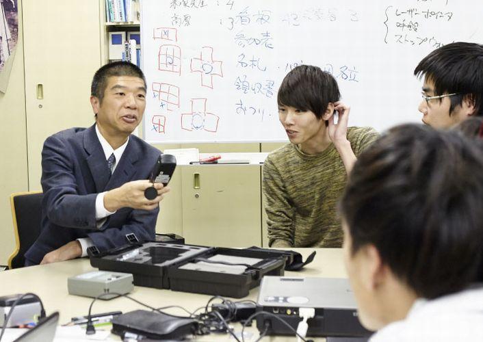
How did Prof. Takagi initially give shape to this method? He started with three measurement devices: LiDAR, which measures the distance and the direction of an object by means of reflected light; SfM, which is one of the fundamental technologies for restoring three-dimensional shape by estimating the camera shooting position of moving images and still images; and UAV, unmanned aerial vehicles, capable of aerial photography. Prof. Takagi used these devices for activities such as 1) simulation of satellite images of forests in Kochi Prefecture; 2) calculation of biomass size; and 3) estimation of the amount of solar radiation striking the forest floor. In order to achieve those outcomes, a highly accurate three-dimensional model is required, but the point cloud data from LiDAR and SfM is enormous. Since the point cloud density is spatially heterogeneous, Prof. Takagi had his eye on voxelization as a method of converting homogeneous data into a small amount of data. Subsequently he succeeded in constructing a method of creating a three-dimensional voxel model of forests using LiDAR, SfM and UAV. The key characteristic of this method of modelling the situation in a wide range of natural environments is the use of a large voxel of 10 cm so that various attribute data can be generated, depending on the application.
As for a data stock method based on a voxel model, a microscopic model exclusively for plants had already been developed in a prior study, but the one they are developing is the first with such a large voxel and such high versatility, which allow use by many people.
Prof. Takagi continues, "It is natural that researchers only get specialized data in their field. For example, soil researchers have data on soil while plant researchers have data on locations where plants grow. Currently there is no system available that allows people to use all data, beyond the boundaries of fields. However, since we have established this method, we are now close to realizing a comprehensive spatial information database. When that happens, researchers will be able to utilize data from other fields and conduct various analyses easily. Then cross-discipline research will accelerate and scientific advances will gain momentum. I would like to create that kind of opportunity."

Prof. Takagi says that he has loved nature since he was a child. In his university student years, as a member of a laboratory dealing with farmland disasters, he devoted his efforts to soil surveys at sites where cliffs had collapsed and landslides had occurred. He began to be interested in the landslide phenomenon in particular.
Prof. Takagi recalls, "Each landslide has a unique cause, shape and size, and no two phenomena are the same. It was really interesting so I thought I would pursue that subject thoroughly."
He wanted to do quantitative analysis of the shape of the earth, so after completing graduate school he started research on artificial satellites as a researcher at the University of Tokyo's Institute of Industrial Science. That research led to his present research activities.
Now Prof. Takagi is about to take up a new approach involving KUT researchers from a wide range of fields. This Satoyama (rural natural area) Regeneration Project aims to build a thriving community by implementing contemporary science and technology in the mountainous areas of Kochi Prefecture.
"Through frequent visits to the mountainous areas of Shikoku during my research, I have come to think that it's important to accept nature as it stands, rather than simply rushing to prevent disasters. Although we already utilize geographic data for disaster prevention, I started to think that the ultimate disaster prevention is to regenerate satoyama."
Science and technology for the conservation and utilization of plants and animals; the utilization of natural energy such as biomass and micro hydraulic power; the improvement of multi-nature infrastructure such as roads, rivers and waterways; the creation of a satoyama base using old folk houses and abolished schools; and the support of the satoyama lifestyle using ICT such as applications for satoyama living. Taking advantage of the knowledge accumulated at KUT, the long term vision is to create a mechanism for maintaining and controlling satoyama. If this project progresses, the target areas should acquire excellent disaster prevention capability and should become places where the residents can live more safely and peacefully in a stable manner.
Prof. Takagi emphasizes, "Tackling big challenges in one field together with researchers from a variety of fields. I think that's fun."
Working with the enormous bank of geographical information data which they have accumulated for the wide region of Shikoku, Prof. Takagi and his team are taking on societal challenges beyond the constraints of individual research fields.
- PREVIOUS
- NEXT